Rocks, landscapes and the people who live with them: reflections from a Finnish researcher in Brazil

Visitors and residents in Atlantic rainforest coast of São Paulo state, the tropical rainforest in Amazonas, and mountainous, urban Rio de Janeiro in Brazil don't necessarily experience the same coastline the same way. For a visitor it can look like paradise to escape to, and for someone living at the foot of the coastal range, the same slopes are increasingly marked by urban pressure and the hazards that come with it. The same rocks and soils also do a lot of unglamorous work, like holding water, storing carbon, and sustaining habitats, which is easy to overlook until it stops working, writes Maija Toivanen, FRONT postdoctoral researcher of geodiversity.
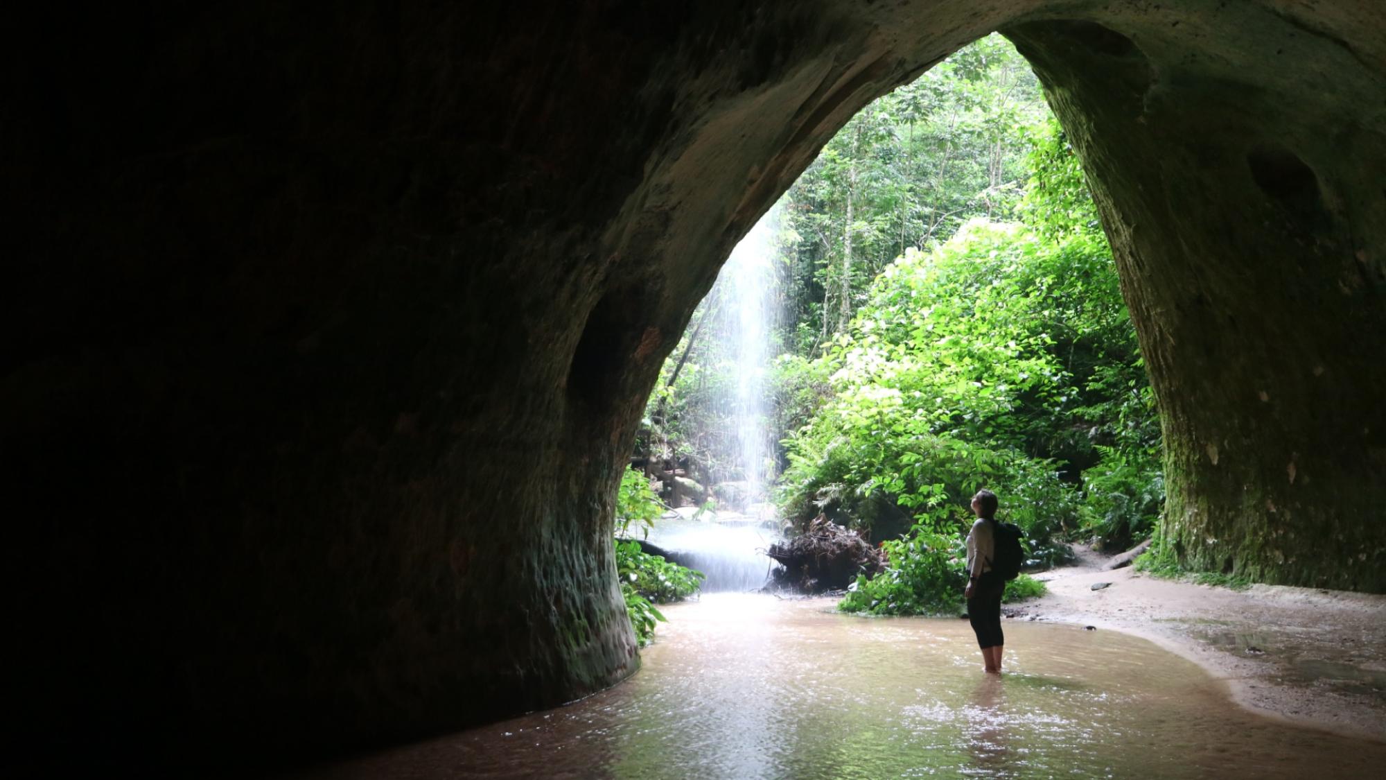
A person standing in an open cave with a background of Amazon waterfall and green forest
Gruta do Maroaga cave, Presidente Figueiredo, Amazonas. Waterfalls are one of the region’s main attractions.

This summer I got funding from FRONT's ROAM programme for a two month-long research visit to the University of São Paulo (USP), hosted by Daniel Santos and Maria da Glória Motta Garcia and their group GeoHereditas. The visit took me to three very different places: the Atlantic rainforest coast of São Paulo state, the tropical rainforest in Amazonas, and mountainous, urban Rio de Janeiro. Here's what stayed with me from each stop.

Things people walk past without noticing

Researchers in GeoHereditas have spent years mapping and assessing geosites along the São Paulo coast, places that record something of the region's geological history. Many sit right in the middle of ordinary beach tourism, and people walk past them on their way to a swim without knowing they are looking at anything special.

That gap is what Oli Miranda Marsiglia, a master's student in the group, has been studying. I sat in on her thesis defence during the visit, on how people perceive geodiversity, or geosciences more broadly, and what that means for communicating or protecting it.

Visitors and residents don't necessarily experience the same coastline the same way. For a visitor it can look like paradise to escape to, and for someone living at the foot of the coastal range, the same slopes are increasingly marked by urban pressure and the hazards that come with it.

The same rocks and soils also do a lot of unglamorous work, like holding water, storing carbon, and sustaining habitats, which is easy to overlook until it stops working.

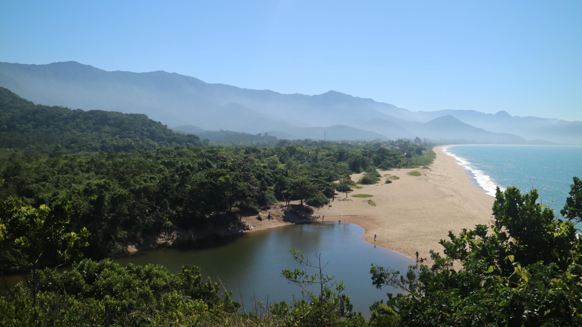
Rorpical blue lagoon with mountains showing in the background
Lagoa Azul in Caraguatatuba.

One of the geosites we visited on our field trip to coastal São Paulo. This freshwater lagoon, fed by the Rio Capricórnio and separated from the sea by a narrow sandbar, shows how geodiversity shapes both landscape and ecosystem services along the north coast. GeoHereditas has produced a virtual tour and 3D model of the site.

A geopark, and what came before it

In Amazonas, we visited the Federal University of Amazonas (UFAM) in Manaus and the area around Presidente Figueiredo, where the Cachoeiras do Amazonas Geopark is being planned. Geoparks are areas where geological heritage is protected and used together with local communities, following a model UNESCO developed.

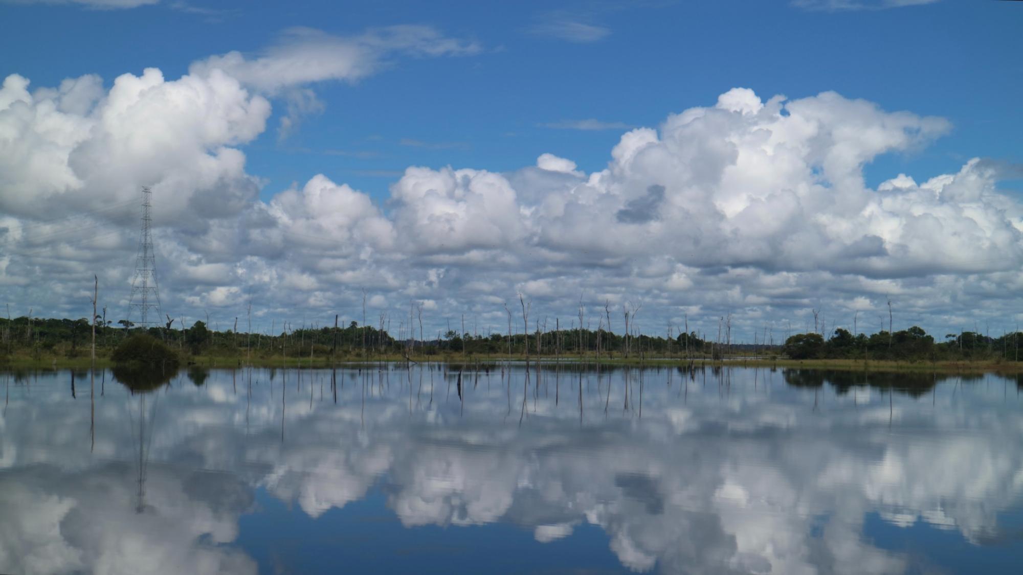
In Presidente Figueiredo, alongside environmental protection, establishing geopark would mean including involving indigenous communities whose history with the land goes back much further than the geopark idea. In the 1980s, their lands were flooded to build a hydropower dam, displacing the people who lived there. What was once a river valley is now a lake, with dead standing forest still visible above the water.

 Dead standing trees in water area and blue sky with clouds
In the northern part of the Balbina reservoir, bordering Waimiri-Atroari Indigenous Land. Dead standing trees mark forest submerged when the land was flooded in the 1980s to build the Balbina dam, and transmission towers carrying power lines are visible in the distance, an energy landscape written into the land itself.


The geopark could be a chance to do something different, a model that combines protection and tourism in a way that also makes room for the communities' own ways of living and using the land, and a way of rebuilding trust with people who have already lost to decisions about their own land, the dam being only one in a longer history of them.

Geoparks are tracked closely against the Sustainable Development Goals, which work as universal targets. But geoparks are about specific places, communities and histories. To account for those local, specific questions, exploring resilience might be an even more useful approach. It's always resilience of someone, against something, over some period of time, and asking those questions helps build up the local context a geopark actually depends on.

Living with the mountains

Rio de Janeiro is a city defined by its mountains. Granite-gneiss inselbergs like Sugarloaf and Corcovado shape the skyline, forcing the city's growth into narrow strips between rock and sea for centuries. A seminar on geodiversity at the Rio de Janeiro State University (UERJ), "III Geodiversidade em Debate", left me thinking about how much one rock has shaped the city.

Facoidal gneiss, the stone that gives the mountains their form, has been quarried and built into the city for centuries, in doorframes, sidewalks, monuments. It holds Rio up in a fairly literal sense: Sugarloaf and Corcovado stand as high as they do because this rock resists weathering better than what surrounds it. It's also what's called a "heritage stone", carrying cultural meaning beyond its geology. No quarry produces it anymore, though. The remaining outcrops sit inside protected or built-up areas, so every building made from it is a little harder to repair each time something breaks or erodes away.

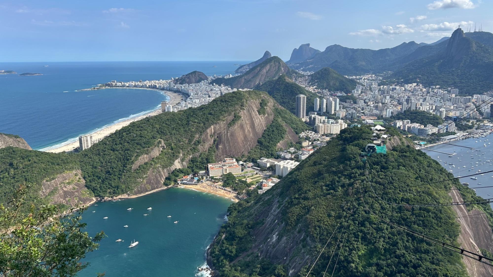
Rio de Janeiro seen from air.
Photo taken from Sugarloaf Mountain, which is one of several granite-gneiss inselbergs that have forced Rio's urban growth into narrow strips between rock and sea.

The seminar's first half also asked a broader question: what makes something geoheritage in the first place? Is it a call only geologists get to make based on scientific significance, or something that can be recognised from the ground up?

A colleague and I have written about something similar, under the label "geological charisma", the idea that people notice and care about a rock or landscape not only because of its scientific value, but because of the encounters they've actually had with it. It echoes the point from earlier: why someone connects to a rock or landscape, and how, can be quite personal.

The same mountains also shape the city's risks. Landslides are a real threat on the steep slopes, and it's often the people with the fewest resources who end up living there. In some places, walls have even been built around informal settlements, or favelas, partly to keep them out of view from tourists.

On a field trip during the seminar, we also visited REVIS Sucavão, a municipal wildlife refuge near Guapimirim created in 2022 to protect this stretch of Atlantic Forest, where agriculture and conservation sit side by side. It felt like a small, working example of conservation and everyday life managing to coexist, not always easily, but coexisting.

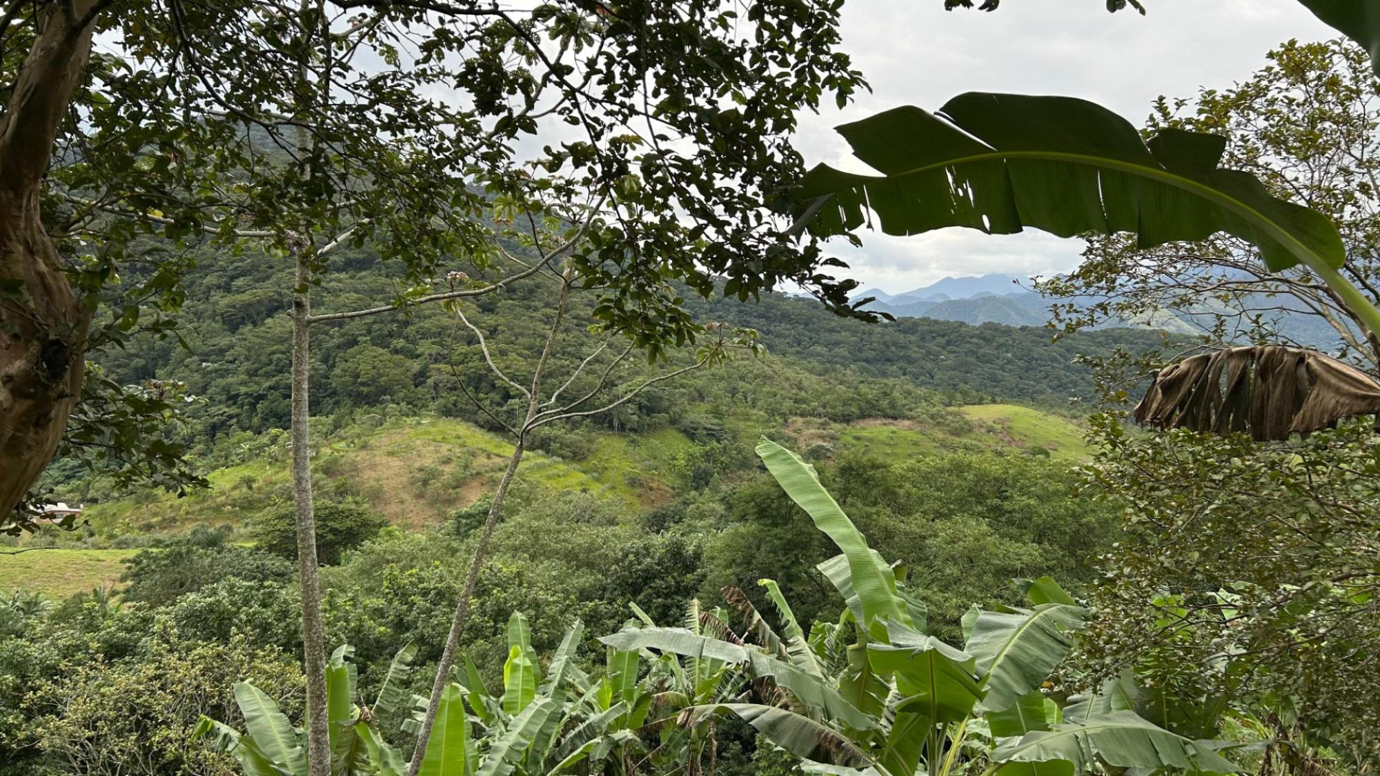
Wildlife refuge in rain forest.
In Sucavão wildlife refuge. The banana plants in the foreground stand on land once cleared of forest and now farmed within the reserve, with cropland and regrowing vegetation visible further up the slope.

I came home with more questions than I left with, which is usually a good sign a research trip worked.

Thanks to FRONT and the ROAM programme for making this trip possible, and to Daniel Santos, Maria da Glória Motta Garcia and the whole GeoHereditas team for hosting and inspiring me.

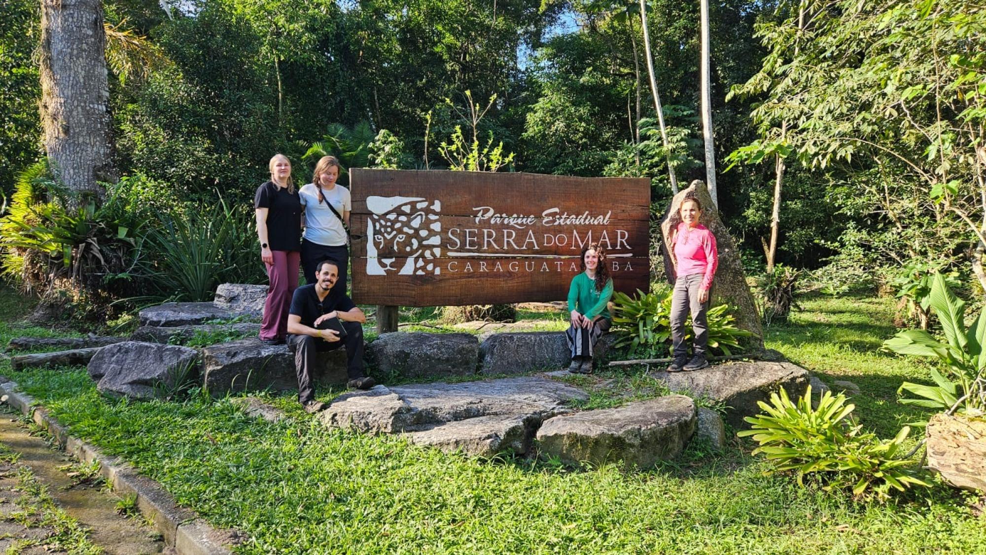
Mar state park in Caraguatatuba with people standing next to sign
Visiting Serra do Mar state park in Caraguatatuba, São Paulo. From left: Helena Tukiainen (University of Oulu), Maija Toivanen (University of Oulu), Daniel Santos (University of São Paulo), Karina de Souza Ibanez (University of São Paulo), and Maria da Glória Motta Garcia (University of São Paulo).

The writer of this boog post is Maija Toivanen, FRONT postdoctoral researcher of geodiversity at the University of Oulu. The research trip was funded by ROAM mobility programme.

Created 21.8.2026 | Updated 21.8.2026